The salinity of the water is the highest in which sea. List of the saltiest seas in the world. Causes of high salinity
Our planet is the owner of about 80 seas, which together make up a certain part of the oceans. All sea water is, to a greater or lesser extent, salty. Our top 10 saltiest seas in the world will tell you about those bodies of water whose waters have the maximum saturation with salts.
10 White Sea
Located in the north of the European part of Russia. Being an inland sea, it belongs to the Arctic Ocean. Its water surface area is only 90,000 square meters. km., which makes it the second (after the Azov) smallest sea. The White Sea is fed by the rivers flowing into it (Mezen, Onega, Kem, Northern Dvina, etc.). This influx of river waters has led to the fact that the salinity of the surface water layer is only 26 ppm, but the salinity of pristine deep water is 31 ppm.
9 Chukchi Sea

It is located between Chukotka and Alaska on the very edge of the Arctic Ocean. The area of its expanses of water reaches 589,600 square meters. km. In winter, the salinity of the under-ice layer of water rises to 33 ppm. In summer, salinity reaches 28 ppm. Such large representatives of the fauna live here - polar bears, walruses, seals, whales, and from fish - navaga, grayling, char, cod, etc.
8 Laptev Sea

Located on the edge of the Arctic Ocean. The area of the surface layer of water is 762,000 square meters. km. Several large rivers flow into it - Lena, Anabar, Khatanga, Olenek, Yana, the waters of which affect the salinity of the sea. Salinity also depends on the melting of ice, on the season, on depth. So, in winter, salinity in the southern part reaches 20-25 ppm, and in the northwestern part it reaches 34 ppm. In summer, salinity decreases to 5-10 ppm and 32 ppm, respectively.
7 Sea of Japan

It is a marginal sea in the Pacific Ocean, separated from it by the Japanese Islands. The surface water area is 1,062,000 sq. km. In winter, ice covers only the northern part of the sea. Salinity of surface waters in the sea fluctuates between 33.7 and 34.3 ppm.
6 Barents Sea

Located on the edge of the Arctic Ocean. The waters of this sea wash the shores of Norway and Russia. The water surface area is 1,424,000 sq. km. The sea is fed by the waters of two large rivers - Pechora and Indiga. Salinity in surface water layers has different values depending on the location: in the north - 33 ppm, in the east - 34 ppm, in the southwest - 35 ppm. In spring and summer, these figures slightly decrease, while in winter they increase. The Barents Sea has a rich flora and fauna.
5 Ionian Sea

It is part of the Mediterranean Sea. The Ionian Sea washes the shores of southern Italy and Greece. Its water surface area is 169,000 sq. km. The bottom of the sea is a basin covered with sediments, the maximum depth of which reaches 5121 m. It is these figures that are the greatest depth of the Mediterranean Sea. Salinity in the surface waters of the sea exceeds 38 ppm.
4 Aegean

It is a semi-enclosed sea with islands, the number of which reaches two thousand. It is part of the Mediterranean Sea and is located between the island of Crete, the Balkan Peninsula and Asia Minor. The water surface area is 179,000 sq. km. The salinity of the surface water layer ranges between 37 and 40 ppm. Water temperature and salinity are constantly increasing, which is provoked by global warming.
3 Mediterranean Sea

This is an intercontinental sea, the area of \u200b\u200bthe surface water layer of which is 2,500,000 square meters. km. After all, its components are 11 seas. The waters of such large rivers as the Tiber, Po, Ebro, Nile and Rhone flow into the Mediterranean Sea. The salinity of the surface water layer ranges between 36 and 39.5 ppm. Such indicators contribute to a large evaporation.
2 Red Sea

It is an inland sea of the Indian Ocean. Located between Africa and the Arabian Peninsula. Its water surface area is 438,000 sq. km. Most of the Red Sea lies in the tropical zone and washes Egypt, Sudan, Saudi Arabia, Israel, Jordan, Yemen, Djibouti, Eritrea. The impeccable transparency of the water in the Red Sea is due to the absence of rivers flowing into it, which usually bring silt and sand into the sea waters. The salinity of the water reaches 42 ppm.
1 Dead Sea

The sea is located between Israel, Jordan and the Palestinian Authority. The area of the water surface is almost 810 sq. km. The water level in the reservoir falls by about 1 m annually. And as a result, the Dead Sea is one of the saltiest reservoirs on Earth. The salinity of its waters is 300-310 ppm.
Each of these seas is unique in its own way. Therefore, if there is an opportunity and desire, it is worth seeing each of them.
Salinity is the amount of dissolved solid mineral substances (salts), expressed in grams, in 1 kg of sea water. A thousandth of a whole is called ppm and is indicated by the sign% o. For example, if the salinity of ocean water is 35% o, then this means that 1 kg (1000 g) of this water contains 35% o (ppm) of dissolved substances.
Salinity is one of the main characteristics of sea water; its value expresses the degree of concentration of all substances dissolved in water (mainly salts).
The salinity value in a particular area of the World Ocean depends on a number of factors: on the inflow of fresh water and the amount of precipitation, the intensity of water evaporation, the formation and melting of ice, and water mixing processes.
Evaporation increases the salinity of seawater as the salts remain in solution. As sea ice melts, salinity decreases because sea ice tends to have less salinity than  salinity of the surrounding waters.
During the formation of sea ice, salinity increases due to the fact that only part of the salts passes into the ice.
What is the salinity of the waters of the World Ocean and its geographical distribution?
Salinity in different places, both on the surface and at the depths of the oceans and seas, is not the same. The average salinity of the waters of the World Ocean is 35% o. 
In the open parts of the oceans, salinity changes little (from 32 to 37.9% o), in the seas it is much more - from 2 (in the Gulf of Finland of the Baltic Sea) to 42% o (in the Red Sea).
The general pattern of changes in salinity across latitudes under the influence of atmospheric precipitation and evaporation is characteristic of all oceans: salinity increases in the direction from the poles to the tropics, reaches a maximum value of about 20-25 ° north and south latitudes and decreases again in the equatorial zone.
The uniform change in salinity in the surface layers is disturbed by the influence of oceanic and coastal currents and enrichment  fresh waters of large rivers. The highest salinity of the World Ocean (S = 37.9% o, not counting some seas, west of the Azores.
The salinity of the seas is the more different from the salinity of the ocean, the less the seas communicate with it; it also depends on their geographical location, in particular on climatic conditions. The salinity of the seas is greater than the oceans: Mediterranean - in the west 37-38% 0, in the east - 38-39% 0;
The salinity of the Red Sea is 37% o in the south, and up to 42% o in the north, in the Persian Gulf in the north the salinity is 40% o, in the eastern part - from 37 to 38% o.
Salinity: in the Sea of Azov in the middle part from 10 to 12% o, and off the coast - 9.5% o. 
Salinity of water in the Black Sea, in the middle part - from 10 to 12% o, and in the northwestern - 17% o, with increasing depth of the sea, the salinity of the water increases to 22% o;
in the Baltic Sea with east winds - 10%o, with western and south-western winds - from 10 to 22%o; in the Gulf of Finland near the island of Kotlin - 2% 0; in the White Sea on the border with the Barents 34-34.5% o, in the Gorla - 27-30% o, and in the middle part - from 24 to 27% o.
In the Caspian Sea, salinity is 12.8% o and in 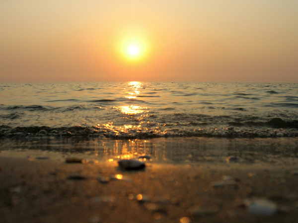 In the Aral Sea, the average salinity is 10.3% o.
The salinity of the Russian Arctic and Far Eastern seas in areas remote from the coast is 29-30% o.
With increasing depth, salinity changes only up to 1500 m, below this horizon and to the bottom - slightly and ranges from 34 to 35% o.
In the polar regions, when ice melts, salinity increases with depth, and when ice forms, the salinity of sea water decreases. 
In temperate latitudes, the salinity of sea water changes little with depth, in the subtropical zone it rapidly decreases to a depth of 1000 m, in the tropical zone it increases to a depth of 100 m, then decreases to a depth of 500 m, after which it slightly increases to a depth of 1500 m, and below remains unchanged.
What is the salinity and density of sea water?
As the temperature drops, the density of salty sea water increases, that is, the sea is saltier in winter than in summer! During the autumn and winter cooling, the water on the sea surface becomes denser, heavier.  With further cooling, surface sea water, being denser and heavier, "sinks" and mixes with warmer and lighter deep water.
This feature of salty sea water contributes to the mitigation of the Earth's climate. When cooling 1 cu. see sea water at 19C 3134 cu. see the air is heated by 1 °C.
The salinity of sea water increases the vertical circulation in the oceans and seas. The air receives much more heat (thermal energy) from the salty waters of the World Ocean than it would receive if the ocean waters were fresh.
The intensity of freezing of sea water and the development of ice phenomena in the seas and oceans depend on salinity. 
The horizontal and vertical distribution of seawater density contributes to the horizontal and vertical circulation of water.
Knowing the vertical distribution of the density of sea water, it is possible to determine the direction and speed of currents, as well as the stability of a particular water mass: if the mass is unstable, then denser water lies above less dense water, and the waters will mix (vertical circulation). 
The density of sea water is of great importance for the inhabitants of the ocean. It determines the stability of the composition of waters, which affects the distribution of organic and inorganic matter in the ocean.
The density of water affects the draft of ships. When moving from ocean water to fresh water and vice versa, their draft can change up to 0.3 m. Therefore, for the correct loading of ships in  ports and ensure the safety of navigation, it is necessary to know the value of salinity and density in the port of loading and at the passage to the sea to the port of destination and take them into account correctly.
Sea water covers two-thirds of our planet and has many unique properties. The main characteristic of sea water is its salinity, which differs in different parts of the world: from 41–42 g/l in the most saline sea to 7 g/l in the freshest. The average salinity of the World Ocean is 34.7 g/l. What is the saltiest sea in the world?
The Red Sea is the saltiest sea in the world
It is the Red Sea that is known as the most salty sea on our planet. The density of salts in its water is 41 g/l, which is one third higher than the average salt content in the oceans. But this does not prevent its numerous inhabitants. The richest flora and fauna of the Red Sea attract thousands of tourists, especially lovers of underwater tourism - diving.
By the way, if someone decides to argue with you about which sea is the most salty - the Dead, whose waters contain 270 g / l of salts, or the Red, you can confidently answer that the Red. The fact is that the Dead Sea, despite its name, is a lake from a scientific point of view, since its waters do not have a drain.
In turn, the Red Sea is distinguished by the fact that it does not have a single river that would flow into it. This is one of the reasons why the water in it is so salty. The climate here is very dry and hot. Water evaporates at a tremendous rate - up to 2 thousand mm per year, but salt remains. Rains are not able to make up for such an amount of evaporation: in total, less than 100 mm of precipitation falls here per year. For comparison: in the central and northern parts of Kazakhstan, 300 – 500 mm of precipitation, in Turkey - 400 – 700 mm, in Ukraine - 600 – 800 mm, in Central Africa - 1800 – 3000 mm per year.
The Red Sea belongs to the Indian Ocean basin. Probably, it would have dried up long ago if not for the Gulf of Aden, which allows it to exchange water with the ocean. The currents move in both directions and replenish the water balance of the Red Sea by thousands of liters per year. On the other hand, it is connected to the Mediterranean Sea through the Suez Canal. Here, too, there is a current, although in an insignificant volume for the scale of the sea.
Sandwiched between the northeast coast of Africa and the Arabian Peninsula, the Red Sea stretches for more than 2,000 km. However, even at its widest point, it remains already many rivers - only 360 m. In some places, its depth reaches 2.2 km, although the average depth of the most salty sea in the world is only 437 m.
Despite the great extent, the salinity of the waters of the Red Sea has almost the same characteristics throughout its entire area (which, by the way, is 450 thousand km2). This is due to the unique natural mechanism of water mixing. In winter, cooling water sinks to the bottom, and retained heat rises to the top. In the summer, the water on the surface becomes heavier due to evaporation and salinity, so this giant mixer works all year round.
Hot depressions, discovered by scientists no more than half a century ago, contribute to the mixing of water. Observations of the temperature and composition of the waters in these depressions suggest that they are heated by heat coming from the bowels of the Earth. Thus, the average water temperature in the Red Sea during the year is kept at 20 – 25 ° C, and in the depressions - 30 – 60 °C, in addition, it increases by 0.3 annually – 0.7°C.
Rivers carry with them not only water, but also sand, silt and garbage, so that the Red Sea, as the only body of water in the world without river flow, retains the incredible transparency of its waters. This makes it one of the most picturesque places on the planet. Coral reefs, thousands of species of bright fish, numerous algae, including those that gave the sea its name - all this is worth seeing with your own eyes. It is important to note that about a third of the local inhabitants are endemic, which means that they can only be found here.
The most salty seas: list
The main contenders for the status of the most salty seas in the world are as follows:
Mediterranean Sea.
The second place in the list of the most salty seas after the Red Sea is occupied by the Mediterranean Sea - 39.5 g / l. Although such salinity can only be felt far from the coast, it still significantly limits the development of small algae and zooplankton, increasing the transparency of the sea waters. Like the Red Sea, the Mediterranean Sea is one of the warmest seas on the planet: even in winter, the water temperature here does not fall below 10 – 12 °C, and in summer it warms up to 25 – 28°C.
The Aegean sea.
The next salinity can be considered the Aegean Sea, washing the shores of Greece and Turkey, as well as the famous island of Crete. Here, the water contains an average of 38.5 g/l of salts, which are characterized by a high sodium content. Doctors recommend that you always rinse after swimming in this sea in order to avoid corroding the surface layers of the skin.
Ionian Sea.
Only slightly behind in salinity is another Greek sea - the Ionian, whose water contains an average of 38 g / l of salts. Here, the high alkali content also makes tourists take better care of their skin. But the high density (highest for sea water) combined with high water temperature (26 – 28 °C in summer) maintains the attractiveness of these places.
Ligurian Sea.
The Ligurian Sea also has a saline density of 38 g/l. This small sea with an area of only 15 thousand km2 is located between the island of Corsica and the Tuscan coast. Many streams flowing into it from the Apennines could not add freshwater to it.
Barents Sea.
The salinity of 35 g / l has the Barents Sea - the most saline sea in Russia. It is located in the north of the European part of Russia and combines the warm waters of the Atlantic Ocean and the cold waters of the Arctic Ocean.
Also in the top ten most salty seas are the Sea of Japan, known for its typhoons (37 – 38 g/l), the Laptev Sea (34 g/l), the Chukchi Sea (33 g/l), and the White Sea (30 g/l).
Interestingly, the Aral Sea, located on the borders of Kazakhstan and Uzbekistan, which, like the Dead Sea, is more of a lake than a sea, may soon catch up with it in terms of salinity. This body of water, which in the middle of the 20th century occupied the 4th place in terms of area among the lakes of the planet, became so shallow that its area decreased by almost 10 times - from 68.9 thousand km2 to 7.3 thousand km2 - in 2014. The salinity of the water during the same time increased 10 times and in 2007 reached 100 g/l.
Despite the diversity, in the World Ocean, the salinity of the waters is much more stable - over the past 50 years, scientists have not been able to notice significant fluctuations. So, when your children and grandchildren start wondering which sea is the most salty in the world, the answer will remain the same - Red. We wish you someday to feel the unique composition of its waters on your own skin and see with your own eyes the diversity of its underwater inhabitants.
The sea is salty. This simple truth is known to everyone who has bathed in it at least once in their life. And those who have not yet experienced such joy, just guess.
After all, everyone knows that although there is really a lot of water on our planet, only a hundredth of it can be drunk. The rest will cause severe indigestion and many pleasant hours on the toilet. And since you can’t drink it, then you can at least swim in it, which is what numerous tourists do with success.
But people love to go to extremes. After swimming in the Black Sea, they want to know what is the saltiest sea in order to be able to compare. And to satisfy your curiosity, we have written this article.
The most salty seas in the world
Before talking about the salinity of various seas, it is necessary to determine what we will start from - that is, the average level, the World Ocean.
The world ocean is not something frozen, it is a huge dynamic system in which liquid constantly mixes, flows from one part to another, and then comes back, evaporates, condenses and falls out as rain. In short, the water cycle is in action. Therefore, the salt content at different points is not the same. But still, there is a certain average level, which is estimated at 32-37 ppm (yes, they do not only measure blood alcohol content).
But at different points of the World Ocean, it can differ significantly, for example, in the bays of the Baltic Sea it reaches a level of 5 ppm. But we are interested in something completely different, which seas are the most salty.
And here comes the crucial moment: what to call the sea. For example, everyone is used to saying "Dead Sea". Meanwhile, it is not correct to call it a sea; in fact, it is a lake. Although it is really very salty, so we will talk about it, but below.
In fact, Red is the saltiest, and it is worth dwelling on it in more detail.
Red sea
The inland sea, which belongs to the Indian Ocean, has an area of 450 square kilometers ... Although who is interested in retelling a textbook on geography? Another thing is more important: this is the most salty sea in the world, there are about 41 ppm of minerals in it. To assess the degree of salinity, mix an incomplete teaspoon of salt in a liter of water. Delicious? But swimming in it is very interesting.
And first of all, because such a composition of water appealed to a huge number of living beings. Sharks, dolphins, moray eels, rays and an unprecedented amount of smaller animals, such as fish, clams and corals, attract tourists from all over the world. And also warm water, beautiful views, clean well-groomed beaches ... The Red Sea is a riot of life that you can enjoy endlessly.
A completely different picture meets us at the Dead Sea (we will not listen to experts in geography and will continue to call it the sea). Alien landscapes, without the usual greenery, healing mud and water, in which, with all the desire, it is impossible to drown - this is his portrait.
This miracle of nature is located between Israel, Jordan and Palestine. Water flows into it, but there is nowhere for it to go, only to evaporate. As a result, the water then evaporates, and the salts remain. Over millions of years, water has accumulated such a percentage of mineral salts that it is possible to stay afloat in it without making any effort, the water itself will push the body out.
This sea is conditionally called the Dead Sea, a couple of species of algae still found shelter in it, but you won’t be able to admire the fish. But it will turn out to be treated, because such water, and also healing mud, which is even more near the sea, is a natural wealth that neighboring countries have long and successfully used.
The only problem is that the Jordan River, the only source of filling this sea, has noticeably decreased in recent years. And now more water evaporates from it than enters. As a result, every year the Dead Sea becomes a little smaller. At this rate, in 100 years it will no longer be possible to swim in it, only walk on the surface. Of course, plans are being developed to save it, but it’s better not to risk it and go to the resort while you can still swim in it.
Domestic record holders
Of course, the most salty sea in Russia is clearly behind the Dead Sea, it has only about 32 ppm. Yes, and swimming is not at all so pleasant, although there are such lovers. This is the Sea of Japan.

Resorts and hotels are not built on it, but this sea is of great economic importance. There is an active fishing industry, various sea delicacies are grown and caught. And along the coast there are more than a dozen ports, both domestic and Japanese.
Another lake-sea
Our neighbors, in Kazakhstan, have an interesting and even unique natural object - the Aral Sea. Although, like the Dead, it can be called a sea rather conditionally, according to the scientific classification, it is classified as a mineral lake. But since the name "sea" has taken root among the people, we will not argue with it.
If it were not for active human activity, the Big Aral would never have made it to this list, because half a century ago the lake had a salinity that was normal for its type, about 10 ppm. But then the water from it began to be used for irrigation of nearby lands. As a result, by 2010 its salinity increased 10 times. A little more, and the Kazakhs will have their own Dead Sea. Dead - in the truest sense of the word, because many of its inhabitants did not agree with such changes and died out as a protest.
There are several projects for its restoration, but so far only the search for the investments necessary for this is underway.
Now you know the saltiest seas and you can choose where to go next time. And if you don’t go, then at least learn more about our planet, its amazing corners and real wonders.
) or PSU units (Practical Salinity Units) of the practical salinity scale (Practical Salinity Scale).
| Element | Content, mg/l |
|---|---|
| Chlorine | 19 500 |
| Sodium | 10 833 |
| Magnesium | 1 311 |
| Sulfur | 910 |
| Calcium | 412 |
| Potassium | 390 |
| Bromine | 65 |
| Carbon | 20 |
| Strontium | 13 |
| Bor | 4,5 |
| Fluorine | 1,0 |
| Silicon | 0,5 |
| Rubidium | 0,2 |
| Nitrogen | 0,1 |
Salinity in ppm is the amount of solids in grams dissolved in 1 kg of sea water, provided that all halogens are replaced by an equivalent amount of chlorine, all carbonates are converted to oxides, organic matter is burned.
In 1978, the practical salinity scale (Practical Salinity Scale 1978, PSS-78) was introduced and approved by all international oceanographic organizations, in which salinity measurement is based on electrical conductivity (conductometry), and not on water evaporation. In the 1970s, oceanographic CTD probes became widely used in marine research, and since then, water salinity has been measured mainly by an electrical method. To verify the operation of electrical conductivity cells that are immersed in water, laboratory salt meters are used. In turn, standard sea water is used to check salt meters. Standard sea water, recommended by the international organization IAPSO for calibration of salt meters, is produced in the UK by Ocean Scientific International Limited (OSIL) from natural sea water. If all measurement standards are observed, salinity measurement accuracy up to 0.001 PSU can be obtained.
The PSS-78 gives numerical results that are close to measurements of mass fractions, and differences are noticeable either when measurements with an accuracy better than 0.01 PSU are needed, or when the salt composition does not correspond to the standard composition of ocean water.
- Atlantic Ocean - 35.4 ‰ The highest salinity of surface waters in the open ocean is observed in the subtropical zone (up to 37.25 ‰), and the maximum is in the Mediterranean Sea: 39 ‰. In the equatorial zone, where the maximum amount of precipitation is noted, salinity decreases to 34 ‰. A sharp desalination of water occurs in the estuarine areas (for example, at the mouth of La Plata - 18-19 ‰).
- Indian Ocean - 34.8 ‰. The maximum salinity of surface waters is observed in the Persian Gulf and the Red Sea, where it reaches 40-41 ‰. High salinity (more than 36 ‰) is also observed in the southern tropical zone, especially in the eastern regions, and in the northern hemisphere also in the Arabian Sea. In the neighboring Bay of Bengal, due to the desalination effect of the Ganges runoff from the Brahmaputra and Irrawaddy, salinity decreases to 30-34 ‰. The seasonal difference in salinity is significant only in the Antarctic and equatorial zones. In winter, desalinated waters from the northeastern part of the ocean are carried by the monsoon current, forming a tongue of low salinity along 5°N. sh. In summer, this language disappears.
- Pacific Ocean - 34.5 ‰. Tropical zones have the maximum salinity (up to a maximum of 35.5-35.6 ‰), where intensive evaporation is combined with a relatively small amount of precipitation. To the east, under the influence of cold currents, salinity decreases. A large amount of precipitation also lowers salinity, especially at the equator and in the western circulation zones of temperate and subpolar latitudes.
- Northern Arctic ocean - 32 ‰. There are several layers of water masses in the Arctic Ocean. The surface layer has a low temperature (below 0 °C) and low salinity. The latter is explained by the freshening effect of river runoff, melt water and very weak evaporation. Below, a subsurface layer stands out, colder (up to −1.8 °C) and more salty (up to 34.3 ‰), formed by mixing surface waters with the underlying intermediate water layer. The intermediate water layer is Atlantic water coming from the Greenland Sea with a positive temperature and high salinity (more than 37 ‰), spreading to a depth of 750-800 m. Deeper lies the deep water layer, which also forms in the Greenland Sea in winter, slowly creeping in a single stream from the strait between Greenland and Svalbard. The temperature of deep waters is about -0.9 ° C, salinity is close to 35 ‰. .
The salinity of ocean waters varies depending on the geographical latitude, from the open part of the ocean to the coast. In the surface waters of the oceans, it is lowered in the equatorial region, in polar latitudes.
| Name | Salinity, ‰ |
|---|---|